


Bagyong Neneng, pasok na sa PAR

ni Lolet Abania | October 13, 2022
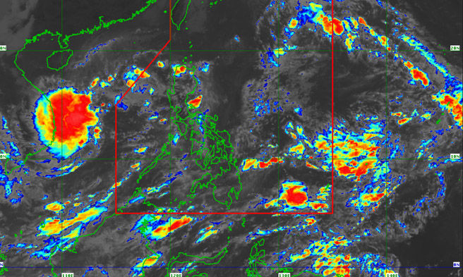
Nakatakdang pumasok sa Philippine Area of Responsibility (PAR) ang isang tropical depression ngayong Huwebes ng hapon na papangalanang Neneng, ayon sa PAGASA.
Sa kanilang 11 AM weather bulletin, sinabi ng PAGASA na ang sentro ng bagyo ay tinatayang nasa layong 1,400 km east ng Extreme Northern Luzon na may maximum sustained winds na 45 km/h malapit sa sentro, gustiness na aabot hanggang 55 km/h, at central pressure na 1004 hPa.
“The Tropical Depression is forecast to move generally westward or west northwestward in the next 12 hours. On the forecast track, it may enter the Philippine Area of Responsibility (PAR) this afternoon,” pahayag ng PAGASA.
“Once inside the PAR, the domestic name ‘NENENG’ will be assigned to this tropical cyclone,” saad pa ng state weather bureau.
Matapos pumasok ng PAR, kikilos ang cyclone sa west southwestward patungong westward simula Biyernes hanggang Sabado bago tahakin ang west northwestward patungong Extreme Northern Luzon.
Inaasahan namang lalakas pa ito habang kumikilos sa Philippine Sea na maaaring umabot sa tropical storm by category ng Sabado.
“The possibility of further intensification prior to its close approach to Extreme Northern Luzon is not ruled out,” sabi ng PAGASA.
Binanggit pa ng ahensiya, “there is ‘high likelihood’ that tropical cyclone wind signals will be raised over Batanes and several provinces in Northern Luzon, with the highest being TCWS No. 2.”



Comments